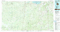
1985 Map of George West
USGS Topo · Published 1992About this map
The Nueces River and Frio River systems dominate this South Texas landscape, converging near the settlement of Three Rivers. During the mid-1980s, the region was undergoing a significant hydrological transformation with the Choke Canyon Reservoir (Under Construction) visible in the northeast. This era of development is juxtaposed with the established ranching and energy-extraction patterns of McMullen and Live Oak counties. The map records a dense network of energy infrastructure, including the Claunch Oil Field, Ezzell Oil Field, and Clay West Oil Field. Moving away from the watercourses, the terrain rises into the Kings Hills and Crater Ridge. Long-standing ranching hubs like Tilden, George West, and the rural community of Los Angeles are connected by a web of state highways and the Missouri Pacific railroad line, which served as a vital corridor for the area's oil and agricultural output.
Find a feature on this map
63 named features on this map. Tap any name to fly to it.
Don’t see what you’re looking for? This feature index may not catch every label — zoom into the map to look around manually.
Map Details
Editions of this 1985 George West Map
2 editions found
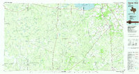
Other maps of this area

1920 · Mikeska
USGS Topo · 1:125,000

1920 · San Diego
USGS Topo · 1:62,500

1925 · Oakville No. 4
USGS Topo · 1:48,000

1925 · Mathis No. 2
USGS Topo · 1:48,000

1925 · Simmons No. 1
USGS Topo · 1:48,000

1925 · Tilden No. 1
USGS Topo · 1:48,000

1925 · Mathis No. 3
USGS Topo · 1:48,000

1925 · Crowther No. 3
USGS Topo · 1:48,000

1925 · Simmons No. 2
USGS Topo · 1:48,000

1927 · Mathis
USGS Topo · 1:62,500