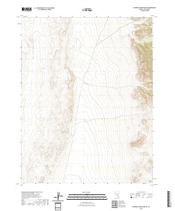
2021 Map of Georges Canyon Rim SE
USGS Topo · Published 2021About this map
West Stone Cabin Valley and the steep slopes of the Hot Creek Range define this high-altitude landscape in central Nevada. The terrain transitions from the alluvial floor of the valley in the west to the rugged interior of Kiln Canyon and the surrounding peaks. Water is scarce in this arid environment, represented here by the seasonal drainage of Willow Cr. Toward the southern edge of the quadrangle, the land opens into the fringes of the Ralston Desert, illustrating the stark contrast between the mountain ranges and the dry basins characteristic of Nye County. The map provides a precise look at the township and range grid system across several sections, including t6n r48e and t5n r49e, which is essential for locating historic land claims and mining interests in this sparsely populated region.
Find a feature on this map
9 named features on this map. Tap any name to fly to it.
Don’t see what you’re looking for? This feature index may not catch every label — zoom into the map to look around manually.
Map Details
Editions of this 2021 Georges Canyon Rim SE Map
This is the sole edition of this map. No revisions or reprints were ever made.
Other maps of this area

1956 · Tonopah
USGS Topo · 1:250,000

1959 · Tonopah
USGS Topo · 1:250,000

1962 · Tonopah
USGS Topo · 1:250,000

1968 · Tybo
USGS Topo · 1:62,500

1968 · Warm Springs
USGS Topo · 1:62,500
1968 · Warm Springs NW
USGS Topo · 1:24,000
1968 · Flagstaff Mtn.
USGS Topo · 1:24,000
1968 · Tybo
USGS Topo · 1:24,000
1971 · Georges Canyon Rim SE
USGS Topo · 1:24,000
1971 · McIntyre Summit
USGS Topo · 1:24,000