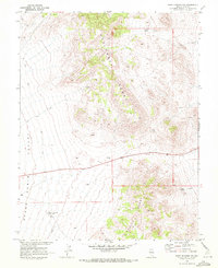
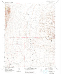
1968 Map of Warm Springs NW
USGS Topo · Published 1972About this map
Hot Creek Range and Kawich Range dominate this Nevada landscape, revealing a remote high-desert terrain shaped by mining and water resources. The topography is marked by several significant operations, most notably the Clifford Mine in the southern sector, alongside various unnamed mines and prospects scattered across the ridgelines. These mineral explorations are connected by a network of jeep trails that navigate the high elevations. Essential water sources like Milk Spring, Black Spring, and an Aqueduct underscore the vital infrastructure required for survival and industry in this arid environment. The map, produced in cooperation with the Atomic Energy Commission, provides a detailed view of the Cabin Valley floor and the surrounding peaks as they were surveyed in the late 1960s.
Find a feature on this map
18 named features on this map. Tap any name to fly to it.
Don’t see what you’re looking for? This feature index may not catch every label — zoom into the map to look around manually.
Map Details
Editions of this 1968 Warm Springs NW Map
This is the sole edition of this map. No revisions or reprints were ever made.
Other maps of this area

1956 · Tonopah
USGS Topo · 1:250,000

1959 · Tonopah
USGS Topo · 1:250,000

1962 · Tonopah
USGS Topo · 1:250,000

1967 · Tybo SE
USGS Topo · 1:24,000

1968 · Tybo
USGS Topo · 1:62,500

1968 · Warm Springs
USGS Topo · 1:62,500
1968 · Warm Springs
USGS Topo · 1:24,000
1968 · Bellehelen
USGS Topo · 1:24,000
1968 · Tybo
USGS Topo · 1:24,000
1968 · Warm Springs SE
USGS Topo · 1:24,000