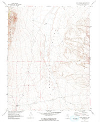
1968 Map of Warm Springs SE
USGS Topo · Published 1973About this map
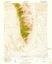
Reveille Valley serves as the central trough of this high-desert landscape, flanked by the steep rising slopes of the Kawich Range to the west and the Reveille Range to the east. This 1968 field-checked survey reveals the ephemeral infrastructure of Nevada's interior, where isolated ranching and mining efforts are marked by a Well, several instances of a Corral, and an Aqueduct cutting across the valley floor. Of particular interest to industrial historians are the Corral Reville Mill (Ruins) and the Reville Mill (Ruins), signifying the area's legacy of ore processing. The map also traces a Jeep Trail winding through the basin, providing the primary access through this arid terrain. Topographic detail includes various benchmarks such as BM 5955 and BM 5779, which assist in orienting the dramatic elevation changes from the basin floor to the mountain peaks.
Find a feature on this map
15 named features on this map. Tap any name to fly to it.
Don’t see what you’re looking for? This feature index may not catch every label — zoom into the map to look around manually.
Map Details
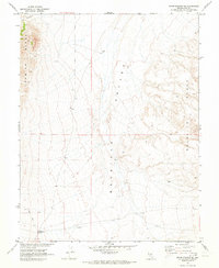
Editions of this 1968 Warm Springs SE Map
2 editions found
Other maps of this area

1908 · Kawich
USGS Topo · 1:250,000
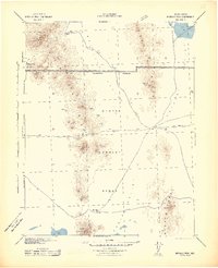
1942 · Reveille Peak
USGS Topo · 1:125,000
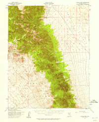
1952 · Kawich Peak
USGS Topo · 1:62,500
1952 · Reveille Peak
USGS Topo · 1:62,500

1954 · Goldfield
USGS Topo · 1:250,000

1955 · Goldfield
USGS Topo · 1:250,000

1956 · Tonopah
USGS Topo · 1:250,000

1958 · Goldfield
USGS Topo · 1:250,000

1959 · Tonopah
USGS Topo · 1:250,000

1962 · Goldfield
USGS Topo · 1:250,000