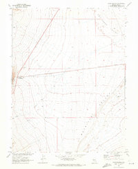
1968 Map of Warm Springs
USGS Topo · Published 1973About this map
Warm Springs serves as the focal point of this Nevada survey, situated where the high desert terrain of Hot Creek Valley meets Reveille Valley. The landscape is defined by its water infrastructure, including a prominent Aqueduct, a Hot Spring, and a Water Tank that supported the small settlement and its associated Trailer Park.
Find a feature on this map
11 named features on this map. Tap any name to fly to it.
Don’t see what you’re looking for? This feature index may not catch every label — zoom into the map to look around manually.
Map Details
Editions of this 1968 Warm Springs Map
2 editions found
Other maps of this area

1956 · Tonopah
USGS Topo · 1:250,000

1959 · Tonopah
USGS Topo · 1:250,000

1962 · Tonopah
USGS Topo · 1:250,000

1967 · Lunar Crater
USGS Topo · 1:62,500

1967 · Buckwheat Rim
USGS Topo · 1:24,000

1967 · Tybo SE
USGS Topo · 1:24,000

1968 · Tybo
USGS Topo · 1:62,500

1968 · Warm Springs
USGS Topo · 1:62,500
1968 · Reveille
USGS Topo · 1:62,500
1968 · Warm Springs NW
USGS Topo · 1:24,000