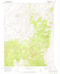
1968 Map of Bellehelen
USGS Topo · Published 1973About this map
Ruins Bellehelen and the nearby Bellehelen Ranch serve as central landmarks in this high-desert mining landscape, where early Nevada industry left its mark across the Kawich Range. This 1968 survey was produced in cooperation with the Atomic Energy Commission, reflecting the strategic importance of the region during the late sixties. The map traces a complex network of canyons, including Bellehelen Canyon and Mikes Canyon, punctuated by critical water sources like Jackson Falls Spring and Tube Spring. Mining activity is evident through the distribution of claims such as the Ajax Mine and Ben Hur Mine. To the west, the flat expanse of Stone Cabin Valley contrasts with the peaks of the Kawich mountains, while the southern reaches contain the seasonal Bellehelen Lake No 1 and Bellehelen Lake No 2, offering a detailed look at the hydrology and prospecting history of Nye County.
Find a feature on this map
25 named features on this map. Tap any name to fly to it.
Don’t see what you’re looking for? This feature index may not catch every label — zoom into the map to look around manually.
Map Details
Editions of this 1968 Bellehelen Map
2 editions found
Other maps of this area

1908 · Kawich
USGS Topo · 1:250,000

1942 · Cactus Range
USGS Topo · 1:125,000

1942 · Reveille Peak
USGS Topo · 1:125,000

1952 · Stinking Spring
USGS Topo · 1:62,500

1952 · Kawich Peak
USGS Topo · 1:62,500

1954 · Goldfield
USGS Topo · 1:250,000

1955 · Goldfield
USGS Topo · 1:250,000

1956 · Tonopah
USGS Topo · 1:250,000

1958 · Goldfield
USGS Topo · 1:250,000

1959 · Tonopah
USGS Topo · 1:250,000