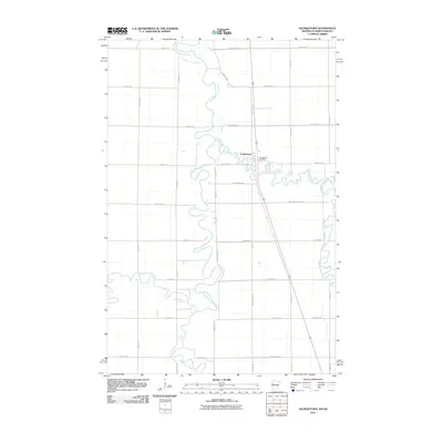
2011 Map of Georgetown
USGS Topo · Published 2011About this map
The confluence of the Buffalo River and the meandering Red River of the North defines this landscape on the border of Minnesota and North Dakota. The settlement of Georgetown serves as the focal point of the quadrangle, where the Georgetown Post Office stands near the intersection of several local routes. The map illustrates a highly organized agricultural grid, with long straight roads such as 150th Avenue North and County Hwy 100 cutting across the fertile Red River Valley. The intricate loops and oxbows of the river systems contrast sharply with the rigid section lines of the surrounding farmland, reflecting a modern rural economy built upon the foundations of one of the region's earliest trading outposts.
Find a feature on this map
38 named features on this map. Tap any name to fly to it.
Don’t see what you’re looking for? This feature index may not catch every label — zoom into the map to look around manually.
Map Details
Editions of this 2011 Georgetown Map
This is the sole edition of this map. No revisions or reprints were ever made.
Other maps of this area

1895 · Fargo
USGS Topo · 1:125,000

1897 · Fargo
USGS Topo · 1:125,000

1952 · Grand Forks
USGS Topo · 1:250,000

1953 · Fargo
USGS Topo · 1:250,000

1956 · Fargo
USGS Topo · 1:250,000

1956 · Grand Forks
USGS Topo · 1:250,000

1959 · Fargo North
USGS Topo · 1:24,000

1959 · West Fargo
USGS Topo · 1:24,000

1963 · Georgetown
USGS Topo · 1:24,000
1963 · Argusville
USGS Topo · 1:24,000