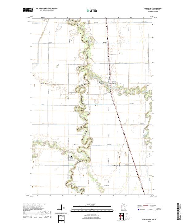
2022 Map of Georgetown
USGS Topo · Published 2022About this map
Georgetown anchors this survey of the fertile Red River Valley, situated at the confluence where the meandering Buffalo River joins the Red River of the North. This borderlands landscape tracks the winding river boundary separating Cass and Clay Counties and the state line between North Dakota and Minnesota. The terrain is characterized by the extreme sinuosity of the rivers, which carve deep loops across the flat agricultural plain. Transportation through the region is dominated by the north-south corridor of US Highway 75, which runs parallel to the primary river system. Near the settlement, Wild Rice Cem serves as a localized landmark for genealogists and local historians documenting the early families who settled this productive river valley.
Find a feature on this map
11 named features on this map. Tap any name to fly to it.
Don’t see what you’re looking for? This feature index may not catch every label — zoom into the map to look around manually.
Map Details
Editions of this 2022 Georgetown Map
This is the sole edition of this map. No revisions or reprints were ever made.
Other maps of this area

1895 · Fargo
USGS Topo · 1:125,000

1897 · Fargo
USGS Topo · 1:125,000

1952 · Grand Forks
USGS Topo · 1:250,000

1953 · Fargo
USGS Topo · 1:250,000

1956 · Fargo
USGS Topo · 1:250,000

1956 · Grand Forks
USGS Topo · 1:250,000

1959 · Fargo North
USGS Topo · 1:24,000

1959 · West Fargo
USGS Topo · 1:24,000

1963 · Georgetown
USGS Topo · 1:24,000
1963 · Argusville
USGS Topo · 1:24,000