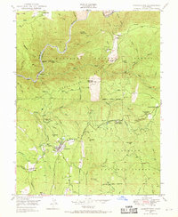
1949 Map of Georgetown
USGS Topo · Published 1969About this map
Gold mining history and timber management converge at Georgetown in the late 1940s, where the community serves as a hub for the surrounding Eldorado National Forest. The landscape is deeply incised by the Middle Fork American River, with several mining locations like Josephine Mine and Buckeye Mine marking the steep slopes. Settlement patterns reflect the area's extraction roots, including former locations like African Bar and Georgia Slide.
Find a feature on this map
63 named features on this map. Tap any name to fly to it.
Don’t see what you’re looking for? This feature index may not catch every label — zoom into the map to look around manually.
Map Details
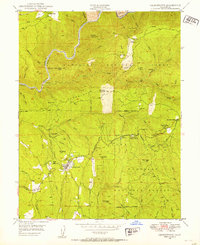
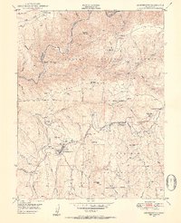
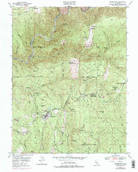
Editions of this 1949 Georgetown Map
4 editions found
Other maps of this area

1891 · Colfax
USGS Topo · 1:125,000

1891 · Placerville
USGS Topo · 1:125,000

1892 · Placerville
USGS Topo · 1:125,000

1892 · Colfax
USGS Topo · 1:125,000

1893 · Placerville
USGS Topo · 1:125,000

1894 · Colfax
USGS Topo · 1:125,000

1898 · Colfax
USGS Topo · 1:125,000

1900 · Colfax
USGS Topo · 1:125,000

1902 · Colfax
USGS Topo · 1:125,000

1938 · Colfax
USGS Topo · 1:125,000