
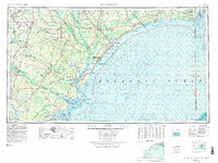
1974 Map of Georgetown
USGS Topo · Published 1978About this map
Winyah Bay serves as the focal point for this coastal survey, where the confluence of the Pee Dee River, Black River, and Sampit River meets the Atlantic. The landscape reflects a mid-1970s balance between established maritime industry in Georgetown and the burgeoning tourism of the Grand Strand, anchored by Myrtle Beach and Garden City Beach. Inland, the economy is defined by the Seaboard Coast Line Railroad connecting timber and agricultural hubs like Andrews and Kingstree. Large-scale conservation and military footprints are prominent, from the sprawling Francis Marion National Forest to the Myrtle Beach Air Force Base. Along the shoreline, the Intracoastal Waterway threads through sensitive estuaries near Murrells Inlet, while the bathymetry details the hazardous Frying Pan Shoals extending from Cape Fear.
Find a feature on this map
213 named features on this map. Tap any name to fly to it.
Don’t see what you’re looking for? This feature index may not catch every label — zoom into the map to look around manually.
Map Details
Editions of this 1974 Georgetown Map
2 editions found
Other maps of this area

1919 · Ladson
USGS Topo · 1:21,120

1919 · Summerville
USGS Topo · 1:48,000

1919 · Wando
USGS Topo · 1:21,120

1919 · Cordesville
USGS Topo · 1:48,000

1919 · Melgrove
USGS Topo · 1:21,120

1919 · Bulls Island
USGS Topo · 1:21,120

1919 · Sewee Bay
USGS Topo · 1:21,120

1920 · Chicora
USGS Topo · 1:48,000

1920 · Mayesville
USGS Topo · 1:48,000

1920 · Manning
USGS Topo · 1:48,000