
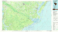
1986 Map of Georgetown
USGS Topo · Published 1986About this map
The port of Georgetown stands at the confluence of the Sampit River, Black River, and Waccamaw River, where they merge into Winyah Bay. In the mid-1980s, this region of the Lowcountry was defined by its massive coastal wetlands and protected forests. The Francis Marion National Forest dominates the southern interior, containing the Hellhole Bay National Wilderness Area and significant swamps like Wambaw Swamp. Along the coast, the complex river deltas of the North Santee River and South Santee River create a network of islands including Cat Island, North Island, and South Island. This map captures the transition from the upland timber and railroad towns of Andrews and Jamestown to the maritime landscapes of McClellanville and the Cape Romain National Wildlife Refuge, showcasing a landscape where water—rivers, the Intracoastal Waterway, and the Atlantic Ocean—dictates settlement and industry.
Find a feature on this map
200 named features on this map. Tap any name to fly to it.
Don’t see what you’re looking for? This feature index may not catch every label — zoom into the map to look around manually.
Map Details
Editions of this 1986 Georgetown Map
2 editions found
Other maps of this area

1919 · Ladson
USGS Topo · 1:21,120

1919 · Summerville
USGS Topo · 1:48,000

1919 · Wando
USGS Topo · 1:21,120

1919 · Cordesville
USGS Topo · 1:48,000

1919 · Melgrove
USGS Topo · 1:21,120

1919 · Bulls Island
USGS Topo · 1:21,120

1919 · Sewee Bay
USGS Topo · 1:21,120

1920 · Chicora
USGS Topo · 1:48,000

1920 · Manning
USGS Topo · 1:48,000

1920 · Ravenels
USGS Topo · 1:62,500