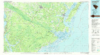
1986 Map of Georgetown
USGS Topo · Published 1990About this map
Georgetown and its historic harbor anchor this coastal landscape, situated where the Black River, Sampit River, and Waccamaw River converge into Winyah Bay. By the mid-1980s, the region's economy was a blend of industrial port activity and large-scale conservation. Inland, the vast reaches of the Francis Marion National Forest dominate the southern half of the sheet, containing designated areas like the Wambaw Swamp National Wilderness. The map captures the complex hydrology of the Lowcountry, from the Intracoastal Waterway to the tangled channels of Wadmacon Island and the South Santee River.
Find a feature on this map
150 named features on this map. Tap any name to fly to it.
Don’t see what you’re looking for? This feature index may not catch every label — zoom into the map to look around manually.
Map Details
Editions of this 1986 Georgetown Map
2 editions found

Other maps of this area

1919 · Ladson
USGS Topo · 1:21,120

1919 · Summerville
USGS Topo · 1:48,000

1919 · Wando
USGS Topo · 1:21,120

1919 · Cordesville
USGS Topo · 1:48,000

1919 · Melgrove
USGS Topo · 1:21,120

1919 · Bulls Island
USGS Topo · 1:21,120

1919 · Sewee Bay
USGS Topo · 1:21,120

1920 · Chicora
USGS Topo · 1:48,000

1920 · Manning
USGS Topo · 1:48,000

1920 · Ravenels
USGS Topo · 1:62,500