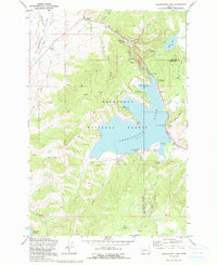
1971 Map of Georgetown Lake
USGS Topo · Published 1991About this map
Georgetown Lake sits as the central landmark of this Montana high-country survey, bordered by the jagged county line between Granite and Deer Lodge counties. The landscape is defined by the early industrial and recreation infrastructure within the Deerlodge National Forest, including a powerplant and aqueduct system that managed the waters of Flint Creek. Along the eastern shore, the Old Railroad Grade traces the historic path of transit through the mountains, while numerous family-named landmarks like Fessler Spring, Blodgett Gulch, and Peterson Meadow provide valuable touchpoints for local genealogy. The map also captures the development of early camping sites such as Piney Campground and Lodgepole Campground, marking the transition of the area from a working resource landscape to a destination for mountain recreation.
Find a feature on this map
39 named features on this map. Tap any name to fly to it.
Don’t see what you’re looking for? This feature index may not catch every label — zoom into the map to look around manually.
Map Details
Editions of this 1971 Georgetown Lake Map
2 editions found
Other maps of this area

1908 · Philipsburg
USGS Topo · 1:125,000

1947 · Butte
USGS Topo · 1:250,000

1958 · Butte
USGS Topo · 1:250,000

1960 · Butte
USGS Topo · 1:250,000

1962 · Butte
USGS Topo · 1:250,000

1971 · Georgetown Lake
USGS Topo · 1:24,000

1971 · Antelope Creek
USGS Topo · 1:24,000

1971 · Potato Lakes
USGS Topo · 1:24,000
1971 · Philipsburg
USGS Topo · 1:24,000
1971 · Fred Burr Lake
USGS Topo · 1:24,000