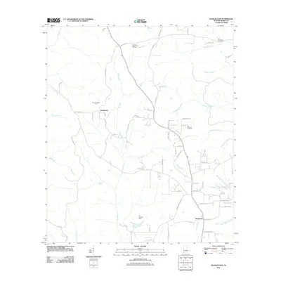
2011 Map of Georgetown
USGS Topo · Published 2011About this map
Boothetown and Georgetown anchor this rural landscape in Mobile County, defined by a network of creeks and family landmarks. The area's spiritual and community history is visible through several burial grounds, including the Old Providence Cemetery, Fellowship Baptist Church Cemetery, and Byrd Memorial Cemetery near Sweetwater Branch. Central to the terrain is Big Creek, which is joined by numerous tributaries such as Pond Branch and Drinking Branch.
Find a feature on this map
71 named features on this map. Tap any name to fly to it.
Don’t see what you’re looking for? This feature index may not catch every label — zoom into the map to look around manually.
Map Details
Editions of this 2011 Georgetown Map
This is the sole edition of this map. No revisions or reprints were ever made.
Other maps of this area

1941 · Creola
USGS Topo · 1:62,500

1942 · Kushla
USGS Topo · 1:31,680

1942 · Deer Park
USGS Topo · 1:62,500

1942 · Wilmer
USGS Topo · 1:62,500

1943 · Creola
USGS Topo · 1:62,500

1943 · Deer Park
USGS Topo · 1:62,500

1943 · Citronelle
USGS Topo · 1:62,500

1944 · Wilmer
USGS Topo · 1:62,500

1946 · Citronelle
USGS Topo · 1:62,500
1953 · Kushla
USGS Topo · 1:24,000