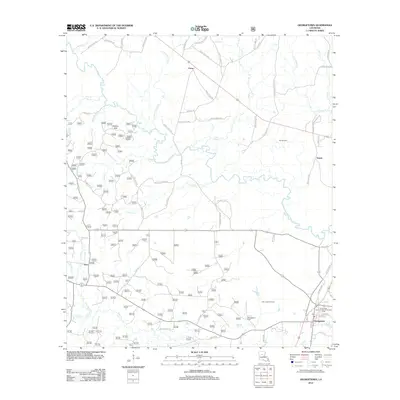
2012 Map of Georgetown
USGS Topo · Published 2012About this map
The Dugdemona River meanders across this Grant Parish landscape, defining the character of a region where timber and petroleum industries meet. In the southeast corner, the town of Georgetown serves as a local hub, anchored by the Georgetown School and Georgetown Cem. The area’s economic reliance on natural resources is evident through the extensive Little Creek-Summerville Oil and Gas Field and the Salt Oil Field further north. Smaller settlements like Curry, Tansey, and Zion are connected by a network of parish roads that navigate around the Pardon Hills and numerous watercourses, including Little Bear Cr and Saline Cr. Local landmarks such as the Beulah Church and several family-named roads like Clayton Holmes Rd and Billy Maxwell Rd offer valuable markers for those researching the genealogy and social geography of this central Louisiana community.
Find a feature on this map
74 named features on this map. Tap any name to fly to it.
Don’t see what you’re looking for? This feature index may not catch every label — zoom into the map to look around manually.
Map Details
Editions of this 2012 Georgetown Map
This is the sole edition of this map. No revisions or reprints were ever made.
Other maps of this area

1932 · Colfax NE
USGS Topo · 1:31,680

1936 · Colfax
USGS Topo · 1:62,500

1936 · Pollock
USGS Topo · 1:62,500

1941 · Pollock
USGS Topo · 1:62,500

1950 · Winnfield
USGS Topo · 1:62,500

1951 · Winnfield
USGS Topo · 1:62,500

1953 · Alexandria
USGS Topo · 1:250,000

1954 · Tullos
USGS Topo · 1:62,500

1955 · Alexandria
USGS Topo · 1:250,000
1956 · Colfax
USGS Topo · 1:62,500