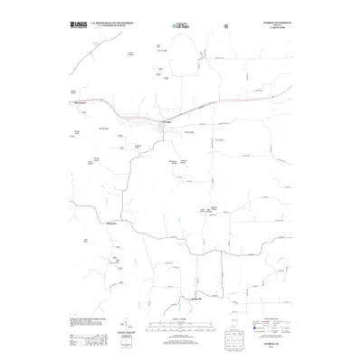
2013 Map of Georgia
USGS Topo · Published 2013About this map
Orangeville and Georgia anchor this study of the southern Indiana landscape, where the meandering course of the Lost River and its tributary, Shirley Cr, define the local topography. This 2013 survey reveals a rural character shaped by significant ridges and hollows, including Toliver Ridge, Burton Ridge, and Tincher Hollow. The map detail shows the transition from these high points to the low-lying areas near Half Moon Lake and Tincher Lake. Small settlements like Moorestown and Hindostan are connected by a network of local roads such as Georgia Rd and Burton Cemetery Rd, which hint at the region's agricultural and social history. The presence of Shirley Creek Horsemans Camp and named local properties like Hager Farms reflects a landscape primarily dedicated to recreation and farming, while the numerous family-named landmarks like Pruett Hollow and Benson Hollow offer clear indicators of local genealogy and land use.
Find a feature on this map
65 named features on this map. Tap any name to fly to it.
Don’t see what you’re looking for? This feature index may not catch every label — zoom into the map to look around manually.
Map Details
Editions of this 2013 Georgia Map
This is the sole edition of this map. No revisions or reprints were ever made.
Other maps of this area

1934 · Bedford
USGS Topo · 1:48,000

1935 · Oolitic
USGS Topo · 1:48,000

1937 · Bedford
USGS Topo · 1:62,500

1942 · Oolitic
USGS Topo · 1:62,500

1948 · Huron
USGS Topo · 1:24,000

1949 · Georgia
USGS Topo · 1:24,000

1950 · Mitchell
USGS Topo · 1:24,000

1950 · Huron
USGS Topo · 1:24,000

1951 · Hillham
USGS Topo · 1:24,000

1951 · French Lick
USGS Topo · 1:24,000