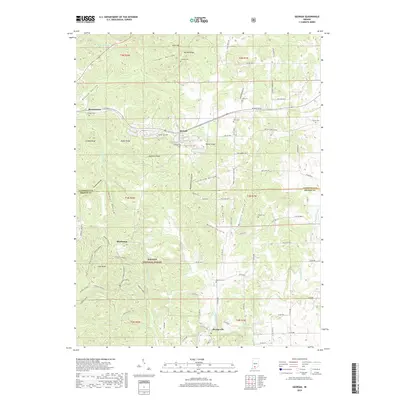
2019 Map of Georgia
USGS Topo · Published 2019About this map
The Lost River system meanders through this portion of the Hoosier National Forest at the border of Lawrence and Orange Counties. The settlement of Georgia sits central to the landscape, surrounded by family-named landmarks like Toliver Ridge and Wadsworth Hollow. This rural terrain is characterized by numerous small burial grounds, including Tincher Cem, Isom Cem, and Georgia Cem, which provide specific points of interest for genealogical research in a region defined by its narrow hollows and high ridges. To the west, the map includes Moorestown and Grodey Ridge, while the southern reaches feature the community of Orangeville. The intricate topography of Tincher Hollow and Felknor Hollow illustrates the complex drainage patterns of the local creek systems, including multiple branches of Shirley Creek 1, which flow through the forested uplands.
Find a feature on this map
79 named features on this map. Tap any name to fly to it.
Don’t see what you’re looking for? This feature index may not catch every label — zoom into the map to look around manually.
Map Details
Editions of this 2019 Georgia Map
This is the sole edition of this map. No revisions or reprints were ever made.
Other maps of this area

1934 · Bedford
USGS Topo · 1:48,000

1935 · Oolitic
USGS Topo · 1:48,000

1937 · Bedford
USGS Topo · 1:62,500

1942 · Oolitic
USGS Topo · 1:62,500

1948 · Huron
USGS Topo · 1:24,000

1949 · Georgia
USGS Topo · 1:24,000

1950 · Mitchell
USGS Topo · 1:24,000

1950 · Huron
USGS Topo · 1:24,000

1951 · Hillham
USGS Topo · 1:24,000

1951 · French Lick
USGS Topo · 1:24,000