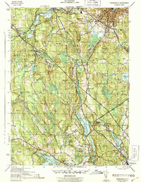
1943 Map of Georgiaville
USGS Topo · Published 1943About this map
Industrial villages and upland farmstead terrain characterize this northern Rhode Island landscape during the mid-war years. The Branch River and Woonasquatucket River drive the local economy, supporting a series of mill settlements including Slatersville, Forestdale, and Georgiaville. The New York New Haven and Hartford railroad cuts through the valley, connecting these manufacturing hubs. Beyond the river corridors, the map reveals a dense network of high points like Woonsocket Hill and Nipsachuck Hill, interspersed with water resources like the Slatersville Reservoir and Woonasquatucket Reservoir. Local history is anchored by landmarks such as The Shrine near Nasonville, the Union Cem, and the Orphanage Mt St Charles in the northeast. This 1943 survey shows the transition from rural Glocester and Burrillville to the more settled industrial fringes of North Smithfield and Smithfield.
Find a feature on this map
72 named features on this map. Tap any name to fly to it.
Don’t see what you’re looking for? This feature index may not catch every label — zoom into the map to look around manually.
Map Details
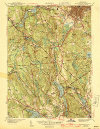
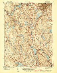
Editions of this 1943 Georgiaville Map
3 editions found
Other maps of this area

1886 · Blackstone
USGS Topo · 1:62,500

1887 · Franklin
USGS Topo · 1:62,500

1887 · Providence
USGS Topo · 1:62,500

1889 · Providence
USGS Topo · 1:62,500

1889 · Blackstone
USGS Topo · 1:62,500

1889 · Franklin
USGS Topo · 1:62,500

1889 · Burrillville
USGS Topo · 1:62,500

1893 · Franklin
USGS Topo · 1:62,500

1893 · Blackstone
USGS Topo · 1:62,500

1894 · Burrillville
USGS Topo · 1:62,500