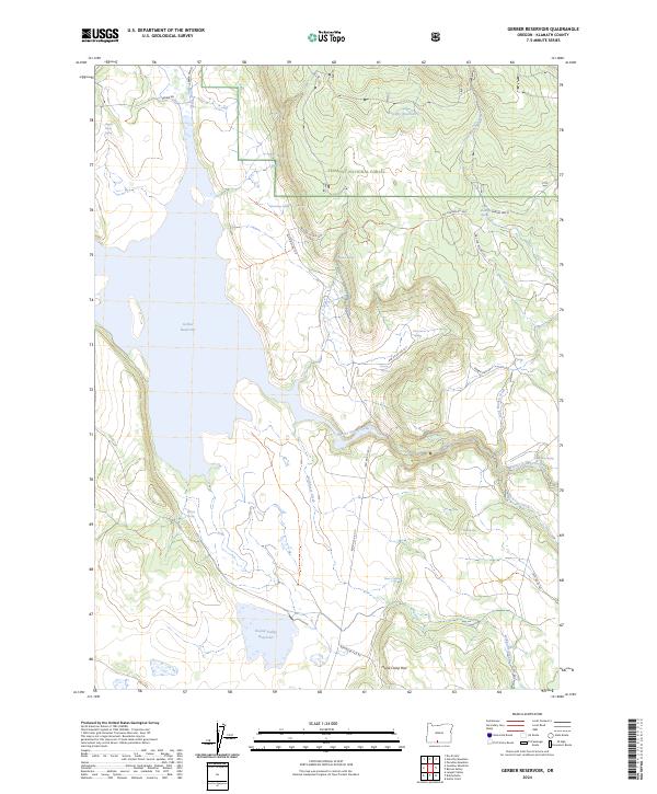
2024 Map of Gerber Reservoir
USGS Topo · Published 2024About this map
Gerber Reservoir dominates this high-altitude landscape in Klamath County, serving as the central drainage for a network of creeks and springs within the Fremont National Forest. The map documents a rugged timber and grazing region, where the historical settlement of Barnes Valley is situated along Barnes Valley Creek. Water management is the primary defining characteristic of the terrain, visible through the presence of Horsefly Reservoir to the north and Round Valley Reservoir to the south.
Find a feature on this map
38 named features on this map. Tap any name to fly to it.
Don’t see what you’re looking for? This feature index may not catch every label — zoom into the map to look around manually.
Map Details
Editions of this 2024 Gerber Reservoir Map
This is the sole edition of this map. No revisions or reprints were ever made.
Other maps of this area

1889 · Klamath
USGS Topo · 1:250,000

1894 · Klamath
USGS Topo · 1:250,000

1955 · Klamath Falls
USGS Topo · 1:250,000

1958 · Klamath Falls
USGS Topo · 1:250,000

1960 · Gerber Reservoir
USGS Topo · 1:62,500

1960 · Bly
USGS Topo · 1:62,500

1960 · Strawberry Butte
USGS Topo · 1:62,500

1960 · Fishhole Mtn
USGS Topo · 1:62,500

1975 · Lakeview
USGS Topo · 1:100,000
1988 · Barnes Valley
USGS Topo · 1:24,000