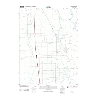
2012 Map of Gerber
USGS Topo · Published 2012About this map
Gerber and the surrounding agricultural lands of Tehama County are defined by a complex network of irrigation and river systems. The Sacramento River marks the eastern boundary, featuring large landforms like Todd Island and Mooney Island. The landscape is engineered for productivity, dominated by the parallel courses of the Tehama Colusa Canal and the Corning Canal, which bisect the valley floor to support local orchards and farms.
Find a feature on this map
78 named features on this map. Tap any name to fly to it.
Don’t see what you’re looking for? This feature index may not catch every label — zoom into the map to look around manually.
Map Details
Editions of this 2012 Gerber Map
This is the sole edition of this map. No revisions or reprints were ever made.
Other maps of this area

1890 · Red Bluff
USGS Topo · 1:250,000

1894 · Red Bluff
USGS Topo · 1:250,000

1904 · Vina
USGS Topo · 1:62,500

1905 · Tehama
USGS Topo · 1:62,500

1944 · Flournoy
USGS Topo · 1:62,500
1950 · Vina
USGS Topo · 1:24,000

1950 · Gerber
USGS Topo · 1:24,000

1951 · Gerber
USGS Topo · 1:24,000
1951 · Vina
USGS Topo · 1:24,000
1951 · Corning
USGS Topo · 1:24,000