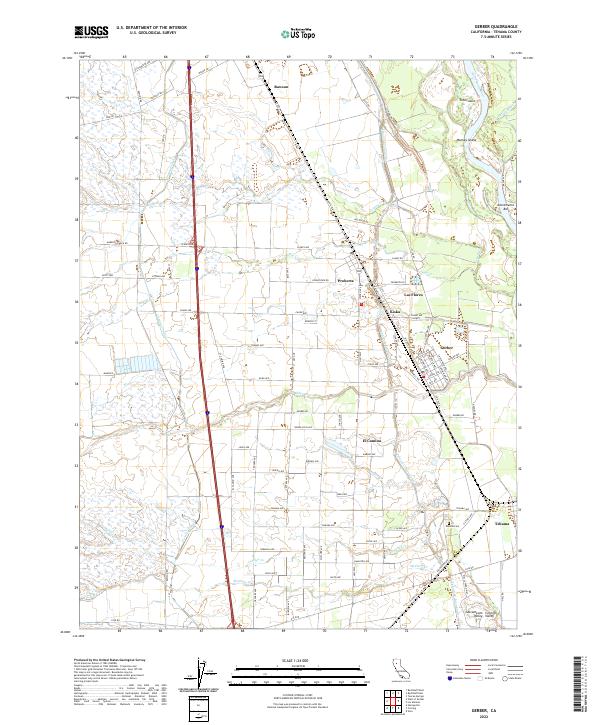
2022 Map of Gerber
USGS Topo · Published 2022About this map
Gerber and Tehama serve as the primary hubs in this agricultural corridor of the Sacramento Central Valley, where water management systems define the landscape. The intricate network of the Corning Canal and the Tehama-Colusa Canal snakes through the territory, supporting the orchards and fields that spread between the Sacramento River to the east and the inland foothills. Smaller settlements like Proberta, Las Flores, and El Camino are connected by a grid of named rural roads, including Marenco Ranch Rd and Hatfield Rd.
Find a feature on this map
100 named features on this map. Tap any name to fly to it.
Don’t see what you’re looking for? This feature index may not catch every label — zoom into the map to look around manually.
Map Details
Editions of this 2022 Gerber Map
This is the sole edition of this map. No revisions or reprints were ever made.