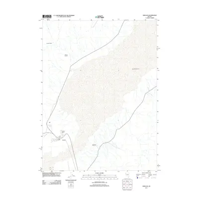
2011 Map of Gerlach
USGS Topo · Published 2011About this map
Gerlach sits as a vital junction in the high desert of northwestern Nevada, serving as a gateway to the alkaline flats of the Black Rock Desert. This 2011 survey details the settlement's infrastructure, including the Gerlach Post Office and the Gerlach Landing Strip, which support the remote community and its seasonal visitors. The surrounding landscape is defined by stark topographic contrasts, from the thermal waters of Great Boiling Spring to the elevated reaches of Granite Basin. Local agricultural and land-use history is evidenced by the Gerlach and Waltz Ranch, while natural drainage patterns are carved into the terrain at Bowen Canyon. The map captures the area just as it became internationally known for large-scale desert gatherings, though it remains primarily a quiet outpost for ranchers and travelers.
Find a feature on this map
7 named features on this map. Tap any name to fly to it.
Don’t see what you’re looking for? This feature index may not catch every label — zoom into the map to look around manually.
Map Details
Editions of this 2011 Gerlach Map
This is the sole edition of this map. No revisions or reprints were ever made.
Other maps of this area

1886 · Granite Range
USGS Topo · 1:250,000

1894 · Granite Range
USGS Topo · 1:250,000

1955 · Lovelock
USGS Topo · 1:250,000

1959 · Lovelock
USGS Topo · 1:250,000

1964 · Gerlach
USGS Topo · 1:62,500

1980 · Dry Mountain NW
USGS Topo · 1:24,000
1980 · The Banjo
USGS Topo · 1:24,000

1980 · Tenmile
USGS Topo · 1:24,000
1980 · Trego
USGS Topo · 1:24,000
1980 · Hualapai Flat South
USGS Topo · 1:24,000