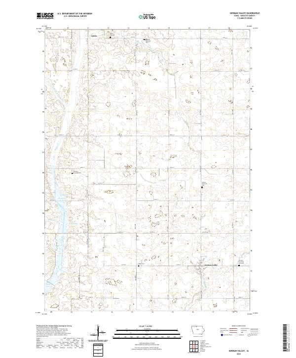
2022 Map of German Valley
USGS Topo · Published 2022About this map
Lakota stands at the northern edge of this Kossuth County landscape, where the agricultural grid of northern Iowa is defined by a complex system of water management. The terrain is marked by numerous engineered waterways, including Drainage Ditch Number 90 and Storks Ditch, which serve to drain the low-lying areas once characterized by features like Dismal Swamp. This 2022 survey illustrates a region where local heritage is preserved in several rural burial grounds scattered across the townships, such as Maple Hill Cem, Ramsey Reformed Cem, and German Township East Cem. The southern reach of the map transitions into the drainage of Little Buffalo Cr near the settlement of German Valley. The interplay of modern naming conventions like Gabrielson Pool and Smith Pool with traditional land divisions highlights the ongoing relationship between the region's farming community and its water-rich environment.
Find a feature on this map
35 named features on this map. Tap any name to fly to it.
Don’t see what you’re looking for? This feature index may not catch every label — zoom into the map to look around manually.
Map Details
Editions of this 2022 German Valley Map
This is the sole edition of this map. No revisions or reprints were ever made.
Other maps of this area

1954 · Fairmont
USGS Topo · 1:250,000

1954 · Mason City
USGS Topo · 1:250,000

1957 · Mason City
USGS Topo · 1:250,000

1958 · Mason City
USGS Topo · 1:250,000

1958 · Fairmont
USGS Topo · 1:250,000

1972 · German Valley
USGS Topo · 1:24,000

1972 · Buffalo Center
USGS Topo · 1:24,000

1972 · Buffalo Center SW
USGS Topo · 1:24,000

1972 · Bancroft
USGS Topo · 1:24,000

1972 · Titonka
USGS Topo · 1:24,000