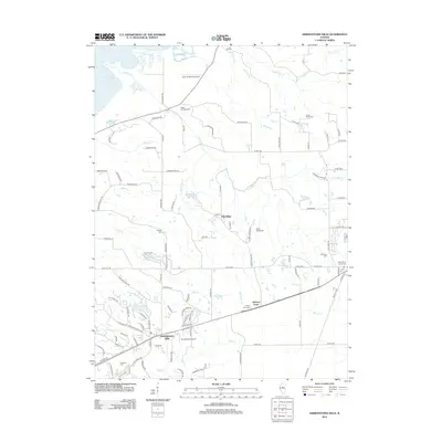
2012 Map of Germantown Hills
USGS Topo · Published 2012About this map
Germantown Hills and the surrounding Woodford County plateau are defined by a complex drainage system that feeds into the Illinois River valley. The landscape is deeply etched by tributaries such as Partridge Cr, Blue Cr, and Wolf Cr, creating a broken terrain that has influenced local settlement patterns and transportation. Rural life is anchored by established community landmarks, including Oak Ridge and Hickory Point, while the presence of two local airfields, John D Rennick Airport and Wernsmans Airport, reflects the modern aerial infrastructure of the region.
Find a feature on this map
110 named features on this map. Tap any name to fly to it.
Don’t see what you’re looking for? This feature index may not catch every label — zoom into the map to look around manually.
Map Details
Editions of this 2012 Germantown Hills Map
This is the sole edition of this map. No revisions or reprints were ever made.
Other maps of this area

1893 · Metamora
USGS Topo · 1:62,500

1893 · Dunlap
USGS Topo · 1:62,500

1898 · Dunlap
USGS Topo · 1:62,500

1905 · Peoria
USGS Topo · 1:62,500

1927 · Peoria
USGS Topo · 1:62,500

1928 · Mackinaw
USGS Topo · 1:62,500

1932 · Mackinaw
USGS Topo · 1:62,500

1932 · Dunlap
USGS Topo · 1:62,500

1933 · Dunlap
USGS Topo · 1:62,500

1937 · Metamora
USGS Topo · 1:62,500