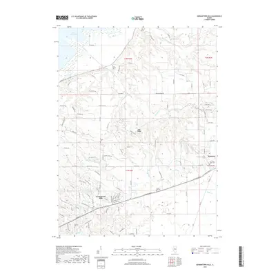
2018 Map of Germantown Hills
USGS Topo · Published 2018About this map
Metamora and Germantown Hills anchor this survey of Woodford County, Illinois, revealing a landscape defined by the drainage systems feeding the Illinois River. The topography transitions from the banks of Upper Peoria Lake in the northwest to the intricate creek valleys of Partridge Cr, Coon Cr, and Blue Cr. The map preserves numerous genealogical sites, including the Saint Marys Roman Cem and Oakwood Cem near Metamora, and the Black Partridge Cem further west, reflecting the area's deep-rooted settlement history. Significant water features such as Wildwind Lake and Izaak Walton Lake are interspersed among established rural routes like Black Partridge Rd and Santa Fe Trl. This documentation of the late 2010s shows the persistent rural character and residential expansion within the historic townships of t27n r2w and t28n r3w.
Find a feature on this map
110 named features on this map. Tap any name to fly to it.
Don’t see what you’re looking for? This feature index may not catch every label — zoom into the map to look around manually.
Map Details
Editions of this 2018 Germantown Hills Map
This is the sole edition of this map. No revisions or reprints were ever made.
Other maps of this area

1893 · Metamora
USGS Topo · 1:62,500

1893 · Dunlap
USGS Topo · 1:62,500

1898 · Dunlap
USGS Topo · 1:62,500

1905 · Peoria
USGS Topo · 1:62,500

1927 · Peoria
USGS Topo · 1:62,500

1928 · Mackinaw
USGS Topo · 1:62,500

1932 · Mackinaw
USGS Topo · 1:62,500

1932 · Dunlap
USGS Topo · 1:62,500

1933 · Dunlap
USGS Topo · 1:62,500

1937 · Metamora
USGS Topo · 1:62,500