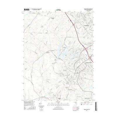
2016 Map of Germantown
USGS Topo · Published 2016About this map
Germantown and the surrounding Montgomery County countryside appear here in high detail, illustrating the modern footprint of a region with deep agricultural and milling roots. The landscape is defined by the significant drainage of Great Seneca Creek and its tributaries, which helped establish local landmarks like Blackrock Mill. Historically significant settlements such as Clarksburg, Boyds, and Darnestown are documented alongside smaller crossroads like Thompsons Corner and Slidell. Local heritage is anchored by several long-standing burial grounds, including the Boyds Presbyterian Cemetery and Asbury United Methodist Cemetery. The map also traces an extensive network of recreational paths, such as the Seneca Ridge Trail and Hoyles Mill Trail, which navigate the terrain surrounding Little Seneca Lake and Black Hill, showing how formerly rural areas have transitioned into a mix of suburban development and preserved parkland.
Find a feature on this map
47 named features on this map. Tap any name to fly to it.
Don’t see what you’re looking for? This feature index may not catch every label — zoom into the map to look around manually.
Map Details
Editions of this 2016 Germantown Map
This is the sole edition of this map. No revisions or reprints were ever made.
Other maps of this area

1893 · Frederick
USGS Topo · 1:125,000

1894 · Frederick
USGS Topo · 1:125,000

1908 · Rockville
USGS Topo · 1:62,500

1908 · Seneca
USGS Topo · 1:62,500

1908 · Ijamsville
USGS Topo · 1:62,500

1909 · Mount Airy
USGS Topo · 1:62,500

1909 · Ijamsville
USGS Topo · 1:62,500

1923 · Rockville
USGS Topo · 1:62,500

1942 · Frederick
USGS Topo · 1:62,500

1944 · Germantown
USGS Topo · 1:31,680