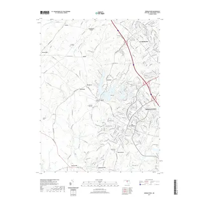
2019 Map of Germantown
USGS Topo · Published 2019About this map
Germantown and its rural Montgomery County surroundings are defined by a complex network of waterways and early Maryland settlements. The central landscape is dominated by Little Seneca Lake and Lake Churchill, which feed into the Little Seneca Creek system. To the north, the historic village of Clarksburg sits near Roberts Tavern, while smaller hamlets like Boyds and Burdette reflect the area's agricultural past.
Find a feature on this map
189 named features on this map. Tap any name to fly to it.
Don’t see what you’re looking for? This feature index may not catch every label — zoom into the map to look around manually.
Map Details
Editions of this 2019 Germantown Map
This is the sole edition of this map. No revisions or reprints were ever made.
Other maps of this area

1893 · Frederick
USGS Topo · 1:125,000

1894 · Frederick
USGS Topo · 1:125,000

1908 · Rockville
USGS Topo · 1:62,500

1908 · Seneca
USGS Topo · 1:62,500

1908 · Ijamsville
USGS Topo · 1:62,500

1909 · Mount Airy
USGS Topo · 1:62,500

1909 · Ijamsville
USGS Topo · 1:62,500

1923 · Rockville
USGS Topo · 1:62,500

1942 · Frederick
USGS Topo · 1:62,500

1944 · Germantown
USGS Topo · 1:31,680