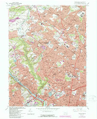
1967 Map of Germantown
USGS Topo · Published 1988About this map
The northern residential reaches and historic neighborhoods of Philadelphia are captured in detail as they appeared in the late 1960s. Dense urban developments in Germantown and Mt Airy give way to the suburban estates of Jenkintown, Wyncote, and Glenside. The map highlights a significant concentration of institutional land use, from the expansive Ivy Hill Cemetery and Holy Sepulchre Cemetery to established academic centers like La Salle College and the Philadelphia College of Textiles and Science.
Find a feature on this map
156 named features on this map. Tap any name to fly to it.
Don’t see what you’re looking for? This feature index may not catch every label — zoom into the map to look around manually.
Map Details
Editions of this 1967 Germantown Map
4 editions found
Other maps of this area

1891 · Philadelphia
USGS Topo · 1:62,500

1893 · Germantown
USGS Topo · 1:62,500

1894 · Chester
USGS Topo · 1:62,500

1894 · Philadelphia
USGS Topo · 1:62,500

1894 · Norristown
USGS Topo · 1:62,500

1894 · Germantown
USGS Topo · 1:62,500

1895 · Norristown
USGS Topo · 1:62,500

1896 · Germantown
USGS Topo · 1:62,500

1896 · Philadelphia
USGS Topo · 1:62,500

1896 · Norristown
USGS Topo · 1:62,500
Featured Places
- Philadelphia, PA
- Abington Township, PA
- Cheltenham Township, PA
- Whitemarsh Township, PA
- Glenside, Cheltenham Township