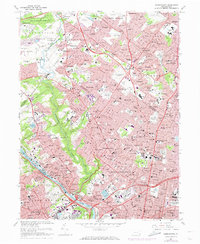
1967 Map of Germantown
USGS Topo · Published 1974About this map
Wissahickon Creek carves a deep green corridor through this densely developed landscape, separating the neighborhoods of Chestnut Hill and Mt Airy from the steep slopes of Roxborough. This 1967 survey, updated with 1973 revisions, reveals the complex urban and suburban fabric of Northwest Philadelphia and southern Montgomery County. The map captures the final years of operation for the extensive Penn Central and Reading railroad networks before their consolidation, showing the numerous commuter stations that fueled the growth of towns like Jenkintown, Glenside, and Bala-Cynwyd.
Find a feature on this map
164 named features on this map. Tap any name to fly to it.
Don’t see what you’re looking for? This feature index may not catch every label — zoom into the map to look around manually.
Map Details
Editions of this 1967 Germantown Map
4 editions found
Other maps of this area

1891 · Philadelphia
USGS Topo · 1:62,500

1893 · Germantown
USGS Topo · 1:62,500

1894 · Chester
USGS Topo · 1:62,500

1894 · Philadelphia
USGS Topo · 1:62,500

1894 · Norristown
USGS Topo · 1:62,500

1894 · Germantown
USGS Topo · 1:62,500

1895 · Norristown
USGS Topo · 1:62,500

1896 · Germantown
USGS Topo · 1:62,500

1896 · Philadelphia
USGS Topo · 1:62,500

1896 · Norristown
USGS Topo · 1:62,500
Featured Places
- Philadelphia, PA
- Abington Township, PA
- Cheltenham Township, PA
- Whitemarsh Township, PA
- Glenside, Cheltenham Township