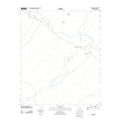
2011 Map of Geronimo
USGS Topo · Published 2011About this map
The Gila River corridor near the San Carlos Apache Reservation is the focal point of this Graham County landscape, where the settlements of Bylas and Emery sit along the winding water and transportation routes. Modern infrastructure like Indian Rte 105 and the arterial Rte 30 connect these communities through an arid terrain marked by prominent landmarks such as Black Point and McKinney Canyon. Local history is anchored at the Geronimo Post Office, a key waypoint in a region shaped by a network of seasonal drainages including Goodwin Wash and Carland Wash. For genealogists and researchers, the area's burial grounds are clearly documented, including the Hinton Cemetery and the Fort Thomas Ward Cemetery, providing a spatial record of the families and communities established in this desert environment during the early 21st century.
Find a feature on this map
22 named features on this map. Tap any name to fly to it.
Don’t see what you’re looking for? This feature index may not catch every label — zoom into the map to look around manually.
Map Details
Editions of this 2011 Geronimo Map
This is the sole edition of this map. No revisions or reprints were ever made.
Other maps of this area

1944 · Jackson Mtn.
USGS Topo · 1:62,500

1946 · Jackson Mtn.
USGS Topo · 1:62,500

1954 · Silver City
USGS Topo · 1:250,000

1954 · Clifton
USGS Topo · 1:250,000

1954 · Mesa
USGS Topo · 1:250,000

1956 · Tucson
USGS Topo · 1:250,000

1957 · Mesa
USGS Topo · 1:250,000

1957 · Clifton
USGS Topo · 1:250,000

1958 · Silver City
USGS Topo · 1:250,000

1958 · Clifton
USGS Topo · 1:250,000