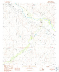
1989 Map of Geronimo
USGS Topo · Published 1990About this map
The Gila Valley serves as a primary corridor for settlement and transit in this late 20th-century Arizona landscape. The San Carlos Indian Reservation occupies the western portion of the map, defined by the Indian Treaty Boundary and the historic Old Military Reservation Boundary. The Gila River meanders across the northern territory, supporting small communities like Bylas and Geronimo.
Find a feature on this map
20 named features on this map. Tap any name to fly to it.
Don’t see what you’re looking for? This feature index may not catch every label — zoom into the map to look around manually.
Map Details
Editions of this 1989 Geronimo Map
This is the sole edition of this map. No revisions or reprints were ever made.
Other maps of this area

1944 · Jackson Mtn.
USGS Topo · 1:62,500

1946 · Jackson Mtn.
USGS Topo · 1:62,500

1954 · Silver City
USGS Topo · 1:250,000

1954 · Clifton
USGS Topo · 1:250,000

1954 · Mesa
USGS Topo · 1:250,000

1956 · Tucson
USGS Topo · 1:250,000

1957 · Mesa
USGS Topo · 1:250,000

1957 · Clifton
USGS Topo · 1:250,000

1958 · Silver City
USGS Topo · 1:250,000

1958 · Clifton
USGS Topo · 1:250,000