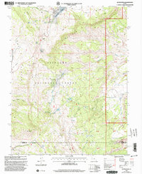
2001 Map of Geyser Peak
USGS Topo · Published 2003About this map
Fish Lake National Forest dominates this high-altitude terrain along the boundary of Sevier and Wayne counties, where the geological transition from Limestone cliffs to the volcanic influence of Geyser Peak is clearly mapped. The landscape is defined by its basins and high plateaus, including the prominent Willow Basin and the wide Garden Basin. These depressions collect water into high-country features such as Floating Island Lake, Meeks Lake, and Morrell Pond.
Find a feature on this map
31 named features on this map. Tap any name to fly to it.
Don’t see what you’re looking for? This feature index may not catch every label — zoom into the map to look around manually.
Map Details
Editions of this 2001 Geyser Peak Map
This is the sole edition of this map. No revisions or reprints were ever made.
Other maps of this area

1885 · Fish Lake
USGS Topo · 1:250,000

1896 · Fish Lake
USGS Topo · 1:250,000

1922 · Emery No.3
USGS Topo · 1:31,680

1952 · Notom 2 NW
USGS Topo · 1:24,000

1952 · Notom 2 NE
USGS Topo · 1:24,000

1952 · Torrey
USGS Topo · 1:62,500

1952 · Loa 1 NE
USGS Topo · 1:24,000

1956 · Salina
USGS Topo · 1:250,000

1960 · Salina
USGS Topo · 1:250,000

1962 · Salina
USGS Topo · 1:250,000