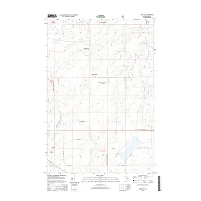
2014 Map of Gibbs City
USGS Topo · Published 2014About this map
Gibbs City and Hazel anchor this section of Iron County, Michigan, where the landscape is defined by the convergence of the North Branch Paint River and South Branch Paint River. Large swaths of the Ottawa National Forest cover the terrain, interspersed with numerous water bodies like Merriman Lake, Webb Lake, and Iron Lake. The map illustrates a region managed for both conservation and recreation, evidenced by the Iron Co ORV & Snowmobile Trl cutting through the timberland. Local roads such as Gibbs City Rd and N Angeli Rd connect isolated homesteads and forest access points, while the southern edge is brushed by US Hwy 2 and the Amvets Hwy. This area represents the classic Upper Peninsula forest economy, where the hydrography of McColman Cr and Edna Cr dictates the local geography.
Find a feature on this map
46 named features on this map. Tap any name to fly to it.
Don’t see what you’re looking for? This feature index may not catch every label — zoom into the map to look around manually.
Map Details
Editions of this 2014 Gibbs City Map
This is the sole edition of this map. No revisions or reprints were ever made.
Other maps of this area

1895 · Perch Lake
USGS Topo · 1:62,500

1898 · Iron River
USGS Topo · 1:62,500

1944 · Iron River
USGS Topo · 1:24,000

1944 · Gaastra
USGS Topo · 1:24,000

1945 · Gibbs City
USGS Topo · 1:24,000

1945 · Sunset Lake
USGS Topo · 1:24,000

1946 · Iron River
USGS Topo · 1:31,680

1946 · Sunset Lake
USGS Topo · 1:31,680

1946 · Gaastra
USGS Topo · 1:31,680

1946 · Gibbs City
USGS Topo · 1:31,680