
1945 Map of Gibbs City
USGS Topo · Published 1945About this map
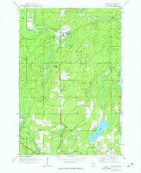
Gibbs City sits at the confluence of the North Branch Paint River and South Branch Paint River, serving as a central point in this mid-century survey of Iron County. The landscape is heavily influenced by the presence of the Ottawa National Forest, which covers much of the northern and central terrain. Cultural markers such as the Finnish Lutheran Ch and the small settlement of Hazel indicate the local community structure during the mid-1940s.
Find a feature on this map
21 named features on this map. Tap any name to fly to it.
Don’t see what you’re looking for? This feature index may not catch every label — zoom into the map to look around manually.
Map Details
Editions of this 1945 Gibbs City Map
2 editions found
Other maps of this area

1895 · Perch Lake
USGS Topo · 1:62,500

1898 · Iron River
USGS Topo · 1:62,500

1944 · Iron River
USGS Topo · 1:24,000

1944 · Gaastra
USGS Topo · 1:24,000

1945 · Sunset Lake
USGS Topo · 1:24,000

1946 · Iron River
USGS Topo · 1:31,680

1946 · Sunset Lake
USGS Topo · 1:31,680

1946 · Gaastra
USGS Topo · 1:31,680

1946 · Gibbs City
USGS Topo · 1:31,680

1954 · Kenton
USGS Topo · 1:62,500