
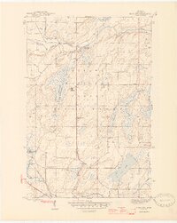
1946 Map of Gibbs City
USGS Topo · Published 1946About this map
Gibbs City serves as a focal point in this portion of the Ottawa National Forest, situated at the confluence where the North Branch and South Branch join to form the main stem of the Paint River. The landscape is defined by its logging and transit history, evidenced by the Chicago and Northwestern railroad line cutting through the southern terrain toward the settlement of Hazel. This postwar survey captures the transition of the Upper Peninsula interior, where former industrial sites like the Old Atkinson Dam Site contrast with community landmarks like the Finnish Lutheran Ch. Further south, the map details the hydrology of the Iron River system, including Iron Lake and numerous feeder streams like Costigan Creek and Sunset Creek. The presence of Camp Gibbs and a prominent Fire Tower highlights the mid-century forest management and recreational character of Iron County.
Find a feature on this map
24 named features on this map. Tap any name to fly to it.
Don’t see what you’re looking for? This feature index may not catch every label — zoom into the map to look around manually.
Map Details
Editions of this 1946 Gibbs City Map
2 editions found
Other maps of this area

1895 · Perch Lake
USGS Topo · 1:62,500

1898 · Iron River
USGS Topo · 1:62,500

1944 · Iron River
USGS Topo · 1:24,000

1944 · Gaastra
USGS Topo · 1:24,000

1945 · Gibbs City
USGS Topo · 1:24,000

1945 · Sunset Lake
USGS Topo · 1:24,000

1946 · Iron River
USGS Topo · 1:31,680

1946 · Sunset Lake
USGS Topo · 1:31,680

1946 · Gaastra
USGS Topo · 1:31,680

1954 · Kenton
USGS Topo · 1:62,500