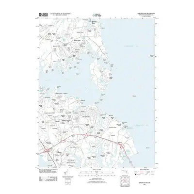
2011 Map of Gibson Island
USGS Topo · Published 2011About this map
Gibson Island sits as a prominent maritime landmark where the Magothy River meets the Chesapeake Bay. This coastal landscape is densely patterned with waterfront communities like Sillery Bay, Ulmstead Cove, and Broadwater Beach, illustrating the intensive residential development along the peninsula's jagged shoreline. Marine navigation is central to the area's identity, anchored by the Baltimore Lighthouse and Sandy Point Lighthouse guarding the shipping channels.
Find a feature on this map
254 named features on this map. Tap any name to fly to it.
Don’t see what you’re looking for? This feature index may not catch every label — zoom into the map to look around manually.
Map Details
Editions of this 2011 Gibson Island Map
This is the sole edition of this map. No revisions or reprints were ever made.
Other maps of this area

1892 · Owensville
USGS Topo · 1:62,500

1892 · Annapolis
USGS Topo · 1:62,500

1893 · North Point
USGS Topo · 1:62,500

1894 · Relay
USGS Topo · 1:62,500

1895 · Owensville
USGS Topo · 1:62,500

1898 · Choptank
USGS Topo · 1:125,000

1898 · Tolchester
USGS Topo · 1:125,000

1899 · Patuxent
USGS Topo · 1:125,000

1903 · Tolchester
USGS Topo · 1:125,000

1904 · North Point
USGS Topo · 1:62,500