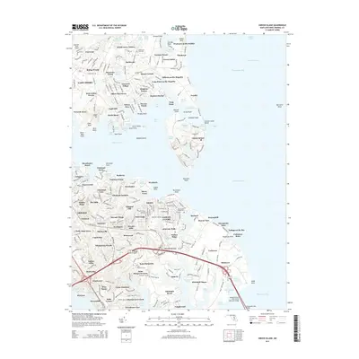
2014 Map of Gibson Island
USGS Topo · Published 2014About this map
Gibson Island and the surrounding Chesapeake shoreline are defined by a complex network of coves and creeks in this 2014 survey. This portion of Anne Arundel County shows the extensive suburban development along the Magothy River, where older settlements like Pinehurst on the Bodkin and Milburn on the Magothy sit alongside modern residential enclaves. The map captures the significant maritime infrastructure serving the region, including the Craighill Channel and the massive William Preston Lane Junior Memorial Bridge spanning toward the eastern shore.
Find a feature on this map
140 named features on this map. Tap any name to fly to it.
Don’t see what you’re looking for? This feature index may not catch every label — zoom into the map to look around manually.
Map Details
Editions of this 2014 Gibson Island Map
This is the sole edition of this map. No revisions or reprints were ever made.
Other maps of this area

1892 · Owensville
USGS Topo · 1:62,500

1892 · Annapolis
USGS Topo · 1:62,500

1893 · North Point
USGS Topo · 1:62,500

1894 · Relay
USGS Topo · 1:62,500

1895 · Owensville
USGS Topo · 1:62,500

1898 · Choptank
USGS Topo · 1:125,000

1898 · Tolchester
USGS Topo · 1:125,000

1899 · Patuxent
USGS Topo · 1:125,000

1903 · Tolchester
USGS Topo · 1:125,000

1904 · North Point
USGS Topo · 1:62,500