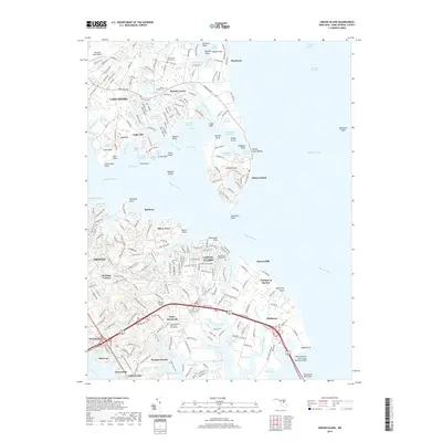
2019 Map of Gibson Island
USGS Topo · Published 2019About this map
Gibson Island and the surrounding Broad Neck peninsula define this reach of the western shore of the Chesapeake Bay. The landscape is a complex network of tidal inlets and coves, including Sillery Bay, Cornfield Creek, and the Magothy River. This modern survey illustrates the residential density of communities like Cape St. Claire and Shore Acres as they integrate with the sensitive estuarine environment. Genealogists can identify several local burial grounds, such as Saint Margarets Episcopal Church Cem and the Cedarwood Cove Cem near Goose Cove. The map also reveals the specific conservation and navigational features of the region, from the Craighill Channel to the ecological preserves of Eagle Hill Bog and Blackhole Creek Bog.
Find a feature on this map
264 named features on this map. Tap any name to fly to it.
Don’t see what you’re looking for? This feature index may not catch every label — zoom into the map to look around manually.
Map Details
Editions of this 2019 Gibson Island Map
This is the sole edition of this map. No revisions or reprints were ever made.
Other maps of this area

1892 · Owensville
USGS Topo · 1:62,500

1892 · Annapolis
USGS Topo · 1:62,500

1893 · North Point
USGS Topo · 1:62,500

1894 · Relay
USGS Topo · 1:62,500

1895 · Owensville
USGS Topo · 1:62,500

1898 · Choptank
USGS Topo · 1:125,000

1898 · Tolchester
USGS Topo · 1:125,000

1899 · Patuxent
USGS Topo · 1:125,000

1903 · Tolchester
USGS Topo · 1:125,000

1904 · North Point
USGS Topo · 1:62,500