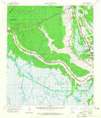
1964 Map of Gibson
USGS Topo · Published 1965About this map
Southern Pacific rail lines and a dense network of bayous define this mid-1960s landscape in Terrebonne Parish, Louisiana. The transition from industrial extraction to traditional agricultural land is visible in the proximity of the Bubbling Bayou Oil and Gas Field to historic estates like Magnolia Plantation and Minerva Plantation. The map captures a moment of residential expansion near Highland Park and Oakshire Manor, alongside specialized local landmarks like the Edward Daigle Drive-in Theater. Navigable waterways such as the Intracoastal Waterway and the Terrebonne Drainage Canal segment the marshy terrain, highlighting the region's reliance on water for transport and drainage. Small settlements like Chacahoula, Donner, and Gibson are connected by rail and road, while numerous country churches and cemeteries, including St Lukes Ch Cem and Beulah Ch, provide critical points of interest for genealogical research.
Find a feature on this map
79 named features on this map. Tap any name to fly to it.
Don’t see what you’re looking for? This feature index may not catch every label — zoom into the map to look around manually.
Map Details
Editions of this 1964 Gibson Map
3 editions found
Other maps of this area

1892 · Lac Des Allemands
USGS Topo · 1:62,500

1892 · Gibson
USGS Topo · 1:62,500

1892 · Houma
USGS Topo · 1:62,500

1892 · Thibodaux
USGS Topo · 1:62,500

1894 · Bayou De Large
USGS Topo · 1:62,500

1894 · Dulac
USGS Topo · 1:62,500

1897 · Gibson
USGS Topo · 1:62,500

1932 · Lake Decade
USGS Topo · 1:62,500

1932 · Lac Des Allemands SW
USGS Topo · 1:31,680

1932 · Houma SW
USGS Topo · 1:31,680