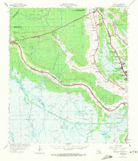
1964 Map of Gibson
USGS Topo · Published 1972About this map
The Southern Pacific railroad corridor anchors this mid-century landscape, threading through Bayou country settlements like Schriever, Donner, and Gibson. The map documents a transition from the area's agricultural past, evidenced by the Magnolia, Minerva, and Rebecca Plantation sites, to a post-war economy driven by extensive energy extraction. Numerous designated zones such as the Hollywood Oil and Gas Field and Sunrise Oil and Gas Field reveal the scale of industrial development south of Bayou Black. Cultural landmarks of the era are well-represented, ranging from the Edward Daigle Drive-in Theater near Broadmoor to numerous rural religious sites like Mt Pilgrim Ch and Beulah Ch. Local genealogists will find value in the specific placement of school-associated cemeteries, including the Price Sch Cem and Schriever Sch Cem, while the intricate network of the Intracoastal Waterway and various drainage canals like the Phillips Canal illustrate the engineering required to manage the wetlands.
Find a feature on this map
93 named features on this map. Tap any name to fly to it.
Don’t see what you’re looking for? This feature index may not catch every label — zoom into the map to look around manually.
Map Details
Editions of this 1964 Gibson Map
3 editions found
Other maps of this area

1892 · Lac Des Allemands
USGS Topo · 1:62,500

1892 · Gibson
USGS Topo · 1:62,500

1892 · Houma
USGS Topo · 1:62,500

1892 · Thibodaux
USGS Topo · 1:62,500

1894 · Bayou De Large
USGS Topo · 1:62,500

1894 · Dulac
USGS Topo · 1:62,500

1897 · Gibson
USGS Topo · 1:62,500

1932 · Lake Decade
USGS Topo · 1:62,500

1932 · Lac Des Allemands SW
USGS Topo · 1:31,680

1932 · Houma SW
USGS Topo · 1:31,680