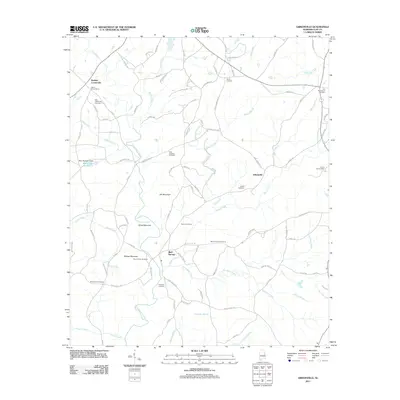
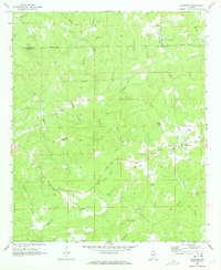
2011 Map of Gibsonville
USGS Topo · Published 2011About this map
Bluff Springs sits at the base of Bishop Mountain, serving as a central point in this part of Clay County where Shool Creek and Loombeam Creek drain the surrounding heights. The landscape is defined by its numerous family and community burial grounds, including the Mount Ararat Cemetery near the mountain and the Patterson Cemetery further south. To the north, Gibsonville and Harkins Crossroads anchor a rural network of roads like Saw Mill Rd and Old Mill Loop, which trace the legacy of local industry alongside the winding course of Enitachopco Creek. The presence of several distinct peaks, such as Jett Mountain and Street Mountain, creates a complex topography that has historically influenced the placement of settlements and transport routes, from the banks of Blair Lake Number 2 to the remote crossings of Rock Pile Creek.
Find a feature on this map
97 named features on this map. Tap any name to fly to it.
Don’t see what you’re looking for? This feature index may not catch every label — zoom into the map to look around manually.
Map Details
Editions of this 2011 Gibsonville Map
This is the sole edition of this map. No revisions or reprints were ever made.
Other maps of this area

1891 · Ashland
USGS Topo · 1:125,000

1953 · Atlanta
USGS Topo · 1:250,000

1957 · Atlanta
USGS Topo · 1:250,000

1958 · Atlanta
USGS Topo · 1:250,000

1969 · New Site
USGS Topo · 1:24,000
1969 · Clairmont Springs
USGS Topo · 1:24,000
1969 · Millerville
USGS Topo · 1:24,000
1969 · Hackneyville
USGS Topo · 1:24,000

1969 · Gibsonville
USGS Topo · 1:24,000
1969 · Daviston
USGS Topo · 1:24,000