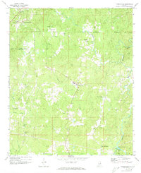
1969 Map of Hackneyville
USGS Topo · Published 1973About this map
Hackneyville and the surrounding rural communities of northern Tallapoosa County are captured here in the late 1960s, showing a landscape defined by small settlements and numerous country churches. The terrain is marked by the winding courses of Hillabee Creek and its many tributaries, including Harbuck Creek and Broken Arrow Creek. This era shows the persistence of local centers like Cleveland Crossroads and Pinckeyville, where life centered around landmarks such as High Sch and Liberty Ch.
Find a feature on this map
40 named features on this map. Tap any name to fly to it.
Don’t see what you’re looking for? This feature index may not catch every label — zoom into the map to look around manually.
Map Details
Editions of this 1969 Hackneyville Map
2 editions found
Other maps of this area

1890 · Talladega
USGS Topo · 1:125,000

1891 · Ashland
USGS Topo · 1:125,000

1892 · Talladega
USGS Topo · 1:125,000

1901 · Wetumpka
USGS Topo · 1:125,000

1903 · Wetumpka
USGS Topo · 1:125,000

1906 · Dadeville
USGS Topo · 1:125,000

1944 · Goodwater
USGS Topo · 1:62,500

1947 · Goodwater
USGS Topo · 1:62,500

1953 · Montgomery
USGS Topo · 1:250,000

1953 · Birmingham
USGS Topo · 1:250,000