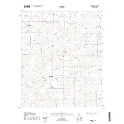
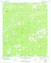
2020 Map of Gibsonville
USGS Topo · Published 2020About this map
Bluff Springs and Gibsonville anchor this survey of the Clay County interior, where the landscape is defined by the winding course of Enitachopco Creek and its many tributaries. The area is marked by a high density of rural burial grounds, including the Old Providence Cem, Patterson Cem, and Mount Carmel Cem, which serve as vital markers for local family history and the locations of earlier community centers. Significant terrain features such as Jett Mtn, Street Mtn, and Bishop Mtn rise above the stream valleys, illustrating the complex topography that shaped settlement and road patterns in this part of Alabama. The map records a network of established county routes like Co Rd 35 and localized paths like Old Mill Loop and Saw Mill Rd, which trace the historical agricultural and timber-related movement through the hills.
Find a feature on this map
110 named features on this map. Tap any name to fly to it.
Don’t see what you’re looking for? This feature index may not catch every label — zoom into the map to look around manually.
Map Details
Editions of this 2020 Gibsonville Map
This is the sole edition of this map. No revisions or reprints were ever made.
Other maps of this area

1891 · Ashland
USGS Topo · 1:125,000

1953 · Atlanta
USGS Topo · 1:250,000

1957 · Atlanta
USGS Topo · 1:250,000

1958 · Atlanta
USGS Topo · 1:250,000

1969 · New Site
USGS Topo · 1:24,000
1969 · Clairmont Springs
USGS Topo · 1:24,000
1969 · Millerville
USGS Topo · 1:24,000
1969 · Hackneyville
USGS Topo · 1:24,000

1969 · Gibsonville
USGS Topo · 1:24,000
1969 · Daviston
USGS Topo · 1:24,000