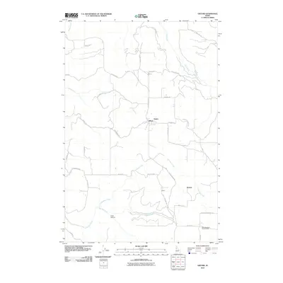
2010 Map of Gifford
USGS Topo · Published 2010About this map
Gifford and Summit anchor this high plateau landscape in Nez Perce County, where the terrain is defined by steep descents and winding canyon access roads. The geography here is marked by dramatic elevation changes, evidenced by the numerous grades required to navigate the topography, including Summit Grade, Magpie Grade, and Kettenbach Grade. These routes descend from the agricultural flats into the drainages of Coyote Creek and Cottonwood Creek, illustrating the challenges of 20th-century transportation in the Idaho panhandle. Small settlement clusters like Eugene and Beeman appear alongside family-named infrastructure such as German Settlement Rd and Charles Rozenkrantz Rd, reflecting the area's deep-rooted ranching and farming heritage. A prominent Lookout and the Wood Brothers Ranch Airport stand as functional landmarks within this sparsely populated rural network, while the incisions of Pickle Canyon and Star Mill Creek break the rolling upland surface.
Find a feature on this map
37 named features on this map. Tap any name to fly to it.
Don’t see what you’re looking for? This feature index may not catch every label — zoom into the map to look around manually.
Map Details
Editions of this 2010 Gifford Map
This is the sole edition of this map. No revisions or reprints were ever made.
Other maps of this area

1924 · Kamiah
USGS Topo · 1:125,000

1955 · Pullman
USGS Topo · 1:250,000

1958 · Pullman
USGS Topo · 1:250,000

1958 · Culdesac
USGS Topo · 1:62,500

1961 · Kendrick
USGS Topo · 1:62,500

1961 · Ahsahka
USGS Topo · 1:62,500

1967 · Fletcher
USGS Topo · 1:24,000

1967 · Peck
USGS Topo · 1:24,000

1981 · Orofino
USGS Topo · 1:100,000

1981 · Potlatch
USGS Topo · 1:100,000