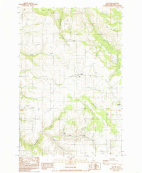
1984 Map of Gifford
USGS Topo · Published 1985About this map
The agricultural plateaus and steep canyon descents of Nez Perce County define this 1980s landscape, centered on the community of Gifford. The map illustrates a region where topography dictates transportation, notably through several named "grades" that negotiate the sharp elevation changes between high farmland and creek beds. These include the Kettenbach Grade, Gifford Grade, and George Grade. To the north, Amos Bench provides a flat expanse before the land drops into Rattlesnake Canyon.
Find a feature on this map
22 named features on this map. Tap any name to fly to it.
Don’t see what you’re looking for? This feature index may not catch every label — zoom into the map to look around manually.
Map Details
Editions of this 1984 Gifford Map
This is the sole edition of this map. No revisions or reprints were ever made.
Other maps of this area

1924 · Kamiah
USGS Topo · 1:125,000

1955 · Pullman
USGS Topo · 1:250,000

1958 · Pullman
USGS Topo · 1:250,000

1958 · Culdesac
USGS Topo · 1:62,500

1961 · Kendrick
USGS Topo · 1:62,500

1961 · Ahsahka
USGS Topo · 1:62,500

1967 · Fletcher
USGS Topo · 1:24,000

1967 · Peck
USGS Topo · 1:24,000

1981 · Orofino
USGS Topo · 1:100,000

1981 · Potlatch
USGS Topo · 1:100,000