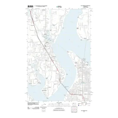
2011 Map of Gig Harbor
USGS Topo · Published 2011About this map
Gig Harbor serves as the central focal point of this maritime landscape, where a high density of nautical infrastructure including the Gig Harbor Seaplane Base, West Shore Marina, and Peninsula Yacht Basin highlights the area's deep-rooted connection to the water. The map documents the critical transit corridors across The Narrows via the Tacoma Narrows Bridge, linking the Kitsap Peninsula to the industrial and residential fringes of Ruston.
Find a feature on this map
60 named features on this map. Tap any name to fly to it.
Don’t see what you’re looking for? This feature index may not catch every label — zoom into the map to look around manually.
Map Details
Editions of this 2011 Gig Harbor Map
This is the sole edition of this map. No revisions or reprints were ever made.
Other maps of this area

1897 · Tacoma
USGS Topo · 1:125,000

1900 · Tacoma
USGS Topo · 1:125,000

1940 · Anderson Island
USGS Topo · 1:62,500

1941 · Tacoma South
USGS Topo · 1:62,500

1942 · Gig Harbor
USGS Topo · 1:62,500

1943 · Gig Harbor
USGS Topo · 1:62,500

1944 · Tacoma South
USGS Topo · 1:62,500

1948 · Anderson Island
USGS Topo · 1:62,500

1948 · Anderson Island
USGS Topo · 1:24,000

1948 · Steilacoom
USGS Topo · 1:24,000