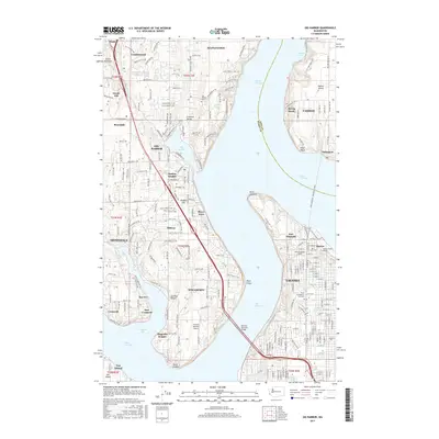
2017 Map of Gig Harbor
USGS Topo · Published 2017About this map
The waters of The Narrows and Colvos Passage define the complex maritime geography of this modern survey, which details the residential and industrial corridors connecting the Kitsap Peninsula to the mainland. At the heart of the landscape is Gig Harbor, its protected inlet surrounded by neighborhoods like Harbor Heights and Shore Acres. On the eastern shore, the urban grid of Tacoma and Ruston meets the expansive greenery of Point Defiance, where the reconstructed Fort Nisqually stands as a landmark of the region's fur-trading era.
Find a feature on this map
50 named features on this map. Tap any name to fly to it.
Don’t see what you’re looking for? This feature index may not catch every label — zoom into the map to look around manually.
Map Details
Editions of this 2017 Gig Harbor Map
This is the sole edition of this map. No revisions or reprints were ever made.
Other maps of this area

1897 · Tacoma
USGS Topo · 1:125,000

1900 · Tacoma
USGS Topo · 1:125,000

1940 · Anderson Island
USGS Topo · 1:62,500

1941 · Tacoma South
USGS Topo · 1:62,500

1942 · Gig Harbor
USGS Topo · 1:62,500

1943 · Gig Harbor
USGS Topo · 1:62,500

1944 · Tacoma South
USGS Topo · 1:62,500

1948 · Anderson Island
USGS Topo · 1:62,500

1948 · Anderson Island
USGS Topo · 1:24,000

1948 · Steilacoom
USGS Topo · 1:24,000