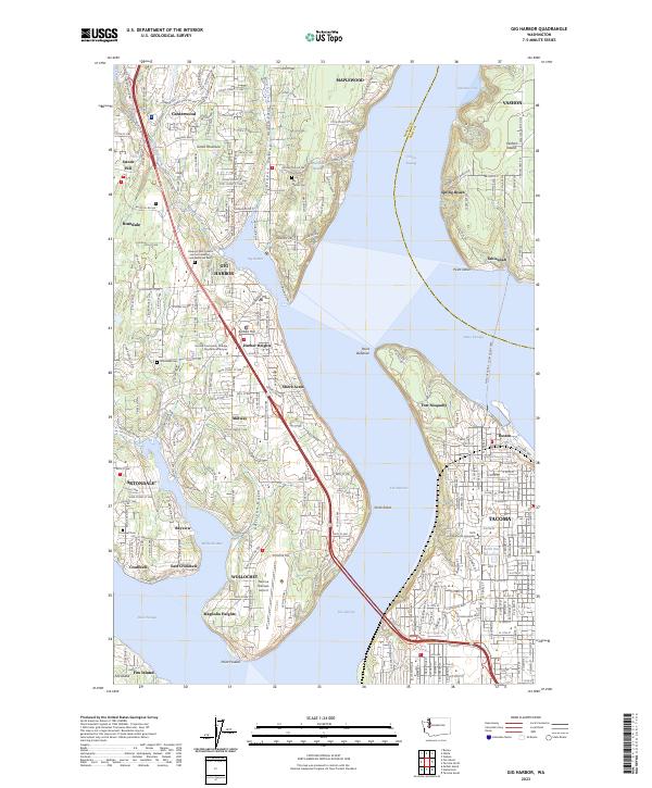
2023 Map of Gig Harbor
USGS Topo · Published 2023About this map
The Gig Harbor waterfront and the northern reach of The Narrows define this maritime landscape on the Great Peninsula. This modern survey details the dense residential growth and complex shoreline of the Pierce Co and King Co border, where the Point Defiance - Tahlequah Ferry links the mainland to Vashon Island. Inland, the map documents significant community landmarks including the Tacoma Community College Gig Harbor Campus and the Tacoma Narrows Airport near Wollochet.
Find a feature on this map
57 named features on this map. Tap any name to fly to it.
Don’t see what you’re looking for? This feature index may not catch every label — zoom into the map to look around manually.
Map Details
Editions of this 2023 Gig Harbor Map
This is the sole edition of this map. No revisions or reprints were ever made.
Other maps of this area

1897 · Tacoma
USGS Topo · 1:125,000

1900 · Tacoma
USGS Topo · 1:125,000

1940 · Anderson Island
USGS Topo · 1:62,500

1941 · Tacoma South
USGS Topo · 1:62,500

1942 · Gig Harbor
USGS Topo · 1:62,500

1943 · Gig Harbor
USGS Topo · 1:62,500

1944 · Tacoma South
USGS Topo · 1:62,500

1948 · Anderson Island
USGS Topo · 1:62,500

1948 · Anderson Island
USGS Topo · 1:24,000

1948 · Steilacoom
USGS Topo · 1:24,000