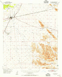
1951 Map of Gila Bend
USGS Topo · Published 1955About this map
Gila Bend serves as the central hub of this desert landscape, situated at the junction of the Southern Pacific and the Cornelia and Gila Bend railroads. The town’s role as a transportation and aviation crossroads is evident through Hunts Airport, a radio range station, and a nearby Auxiliary Airfield. To the north, the Gila River flows past the Gila Bend Indian Reservation and the settlement of Sil Murk, while the Gila Bend Canal cuts across the arid plains. The southern and eastern portions of the map transition into the prominent Maricopa Mountains and the expansive Williams Military Reservation. This 1950s survey documents a critical period of infrastructure, where isolated outposts like Ninemile Well and Halfway Corral provide essential points of reference amidst the various washes and peaks, including the uniquely named Jack in the Pulpit.
Find a feature on this map
30 named features on this map. Tap any name to fly to it.
Don’t see what you’re looking for? This feature index may not catch every label — zoom into the map to look around manually.
Map Details
Editions of this 1951 Gila Bend Map
3 editions found
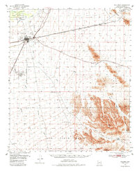
Other maps of this area

1950 · Theba
USGS Topo · 1:62,500

1951 · Estrella
USGS Topo · 1:62,500

1951 · Gila Bend
USGS Topo · 1:62,500

1951 · Theba
USGS Topo · 1:62,500

1951 · Mobile
USGS Topo · 1:62,500

1951 · Cotton Center
USGS Topo · 1:62,500

1951 · Woolsey Peak
USGS Topo · 1:62,500

1953 · Ajo
USGS Topo · 1:250,000

1954 · Phoenix
USGS Topo · 1:250,000

1957 · Ajo
USGS Topo · 1:250,000