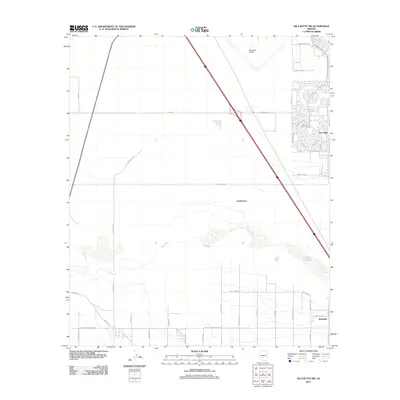
2011 Map of Gila Butte NW
USGS Topo · Published 2011About this map
The Gila River cuts a wide, sandy path through the desert floor south of Chandler, anchoring a landscape where ancient habitation and modern residential planning meet. In the central portion of the sheet, Snaketown represents a vital connection to the area's deep indigenous history. To the south, the settlement of Bapchule sits near a network of local routes including Saint Peters Mission Rd and Wet Camp Rd, illustrating the rural development of the Gila River Indian Reservation. In stark contrast, the northeast corner shows the planned expansion of Sun Lakes, featuring the circular layouts of the Sun Lakes Golf Course and retirement communities. The transition from the structured blocks of Sun Lakes to the open tracts and local tracks like Indian Rte 80 highlights the diverse land use patterns in this part of Arizona during the early 21st century.
Find a feature on this map
43 named features on this map. Tap any name to fly to it.
Don’t see what you’re looking for? This feature index may not catch every label — zoom into the map to look around manually.
Map Details
Editions of this 2011 Gila Butte NW Map
This is the sole edition of this map. No revisions or reprints were ever made.
Other maps of this area

1912 · Phoenix
USGS Topo · 1:62,500

1913 · Mesa
USGS Topo · 1:62,500

1913 · Maricopa
USGS Topo · 1:62,500

1914 · Gila Butte
USGS Topo · 1:62,500

1914 · Phoenix
USGS Topo · 1:62,500

1915 · Mesa
USGS Topo · 1:62,500

1915 · Maricopa
USGS Topo · 1:62,500

1917 · Gila Butte
USGS Topo · 1:62,500

1952 · Gila Butte SE
USGS Topo · 1:24,000

1952 · Maricopa
USGS Topo · 1:24,000